Please note that views expressed at our lectures and events do not necessarily represent the views or policy of the PEF, but are the speaker's and audience's own.
PEF EVENT
Thursday 11th June 2026, 6pm
Syria's Cultural Heritage after Fourteen Years of Conflict: Loss, Resilience and Recovery
- Hiba Alkhalaf, Birkbeck College, University of London
- PEF, 5-6 Dreadnought Walk, Greenwich, London SE10 9FP
- Free, please email rsvppef@gmail.com to reserve your ticket/s
This talk explores the condition of Syria’s cultural heritage after fourteen years of conflict, focusing on material loss, social rupture and institutional collapse. It outlines current threats and urgent needs, while considering emerging responses since the fall of the Assad regime on 8 December 2024. The talk highlights the need to move from reactive emergency measures towards proactive, community-centred approaches that support recovery, reconciliation, transitional justice and the rebuilding of social fabric.
PEF EVENT
Thursday 21st May 2026, 6pm
Origins & Peculiarities of Early Urban Experiences in Palestine & Jordan: A View from Jericho and Batrawy.
- Lorenzo Nigro, La Sapienza University of Rome
- PEF, 5-6 Dreadnought Walk, Greenwich, London SE10 9FP
- Free, please email rsvppef@gmail.com to reserve your ticket/s
This lecture offers a comparative perspective on the rise of early urbanism in the southern Levant through two exceptional archaeological sites: Tell es-Sultan/Jericho in Palestine and Khirbet al-Batrawy in Jordan. From the long developmental sequence of Jericho to the strongly fortified urban centre of Batrawy, the two sites reveal different trajectories towards city life in Palestine and Transjordan. By examining fortifications, public architecture, storage systems, and the relationship between settlement, resources, and power, the talk highlights both the shared foundations and the regional peculiarities of early urban experience. Together, Jericho and Batrawy provide a unique vantage point from which to reconsider the origins, diversity, and resilience of the earliest cities in the southern Levant. The work of archaeologists on the ground aims at preserving this invaluable piece of Humankind Heritage especially at Jericho, a highly threatened site during the current dramatic situation of Palestine.
PEF EVENT
Friday 17th April 2026, 6pm
Developing Capacities in Marine Cultural Heritage Management and Preservation.
- Georgia Andreou, University of Southampton & Julia Nikolaus, Ulster Univeristy
- PEF, 5-6 Dreadnought Walk, Greenwich, London SE10 9FP
- Free, please email rsvppef@gmail.com to reserve your ticket/s
This talk presents the outcomes of the project Developing Capacities in Marine Cultural Heritage Management and Protection, delivered in partnership with the Palestine Exploration Fund and supported by the Cultural Protection Fund. The project addressed the acute vulnerability of Palestine’s maritime and coastal heritage, particularly in Gaza, where conflict, displacement, and large-scale destruction have severely impacted cultural heritage. At the same time, it situated Palestinian capacity building within a wider regional framework of collaboration with Libya and Egypt.
Central to the project was the development of locally led capacity for maritime and coastal heritage documentation in Palestine and Libya. Training in GIS, coastal and underwater survey, first aid, and documentation methodologies equipped heritage professionals and archaeology students to respond rapidly to maritime heritage loss. This approach has been especially critical in Gaza, where underwater and coastal archaeological sites represent some of the few intact links to the past amid widespread destruction on land.
Parallel training and fieldwork in Libya fostered regional knowledge exchange and strengthened professional networks across borders. Beyond technical training, the project supported planning for a Palestine-based maritime archaeology unit, foregrounding heritage as cultural continuity and resistance to erasure.
PEF EVENT
Thursday 19th March 2026, 6pm
The Role of Animals at Medieval Islamic Zughar in the Bilad ash-Sham: preliminary zoological analyses.
- Louise Martin & Marie Middleton, UCL, Konstantinos Politis, HSNES
- PEF, 5-6 Dreadnought Walk, Greenwich, London SE10 9FP
- Free, please email rsvppef@gmail.com to reserve your ticket/s
Khirbat ash Sheik ‘Isa (KSI) in modern Jordan;s Ghor as-Safi was the important market centre (souk) known as Zughar in Bilad ash-Sham during the Early and Middle Islamic periods (9-10C AD and 12-14C AD), based on specialist agricultural production for export (notably indigo in teh 9-10C, and cane sugar in the 12-14C). This presentation draws on the zooarchaeological study of the animal bones from KSI, to explore whether they reflect earlier and later Islamic periods, such as increased specialisation of livestock management aimed at creating market surpluses to feed labouring populations. We also discuss whether the market centre shows relative autonomy in livestock production or was more likely provisioned by herds from further afield for consumption. Identifying practices of harnessing animal power is also highly relevant to an agricultural market centre where both intensive ploughing would be needed, but also pack animals – beasts of burden – for regional trade and transport. Aslo for consideration is the integration of animal and crop management at Medieval Zughar.
PEF EVENT
Thursday 19th February 2026, 6pm
Witnessing through Art: Exploring Palestinian heritage within the collection of the PEF.
- Artists working with the PEF's collections
- PEF, 5-6 Dreadnought Walk, Greenwich, London SE10 9FP
- Free, please email rsvppef@gmail.com to reserve your ticket/s
At this event, we will be engaging with artists who access archives, including those of the PEF, to explore their personal links to the cultural heritage of Palestine and the Middle East. We will discover what motivates their research, and how their engagement results in some surprising and novel ways to reconnect and explore their cultural heritage, find inspiration, and share this connection with a wider audience.
PEF EVENT
Thursday 4th December 2025, 6pm
How I Discovered the Middle East: A Jane Taylor Adventure Story.
- with Jane Taylor, introduced by Bob Bewley
- PEF, 5-6 Dreadnought Walk, Greenwich, London SE10 9FP
- Free, please email rsvppef@gmail.com to reserve your ticket/s
As a colonial child – born in Malaya (as it was called then) and brought up there, in Tasmania and finally in West Sussex – the Middle East was never in my line of sight. Until I went to university. As part of my Mediaeval History degree at St Andrews, I came face to face with the Byzantine Empire – at its greatest extent reaching to the northern tip of the Arabian Peninsula. How wild, I thought.
While my early working life kept me firmly rooted in Britain, by 1971 I was thirsting for a break from orthodoxy. Casting around the world for somewhere to go for a year or so, I miraculously chose Istanbul. There, early in my stay, I was picked up by the BBC to research a TV series on the history and art of Turkey. And so began my freelance life in TV.
Back in London, moonlighting between TV jobs, I was asked if I would like to accompany a tour to Jordan and Syria – would I not! The lecturer had Jordanian friends, who were amazingly generous to the whole group – and they became my friends. They even suggested I go back there to photograph yet more spectacular landscapes and antiquities. On one visit in 1985, a chance question and a surprisingly positive answer led to my first opportunity to photograph from a Royal Jordanian Air Force helicopter – thus was my first Jordan book, High Above Jordan, was born. When it came out in early 1989 I went to live in Amman – I thought for a year – to help promote the book. One year turned into 27.
From that special base in the Middle East, I visited, photographed and/or wrote about Palestine, Lebanon, Syria, Egypt, Yemen, Iraq, Iran and Saudi Arabia. And I produced several more Jordan books…a process which is ongoing.
About the speakers
PEF EVENT
Thursday 6th November 2025, 6pm
The Ruins of Local Memory: Oral Histories at the archaeological site of Dura-Europos, Syria.
- Jen Baird, Birkbeck College, University of London
- PEF, 5-6 Dreadnought Walk, Greenwich, London SE10 9FP
- Free, please email rsvppef@gmail.com to reserve your ticket/s
The history of Salihiyeh, the settlement on the Euphrates immediately beneath the plateau on which the Roman-era site of Dura-Europos sits, has always been entangled with that of the ruins. People from the village have long provided the labour for the excavations, and yet their contribution has been all but invisible in accounts of the site. This talk will present results of oral history research, conducted with my colleague Adnan Almohamad, which attempts to address such absences, and examines the ongoing relationship between communities and archaeological heritage in Syria.
About the speaker
PEF EVENT
Thursday 4th September 2025, 6pm
Hold the Line: Byzantine Archaeology in Colonial Palestine, c.1800 - 1948
- Daniel Reynolds, University of Birmingham
- PEF, 5-6 Dreadnought Walk, Greenwich, London SE10 9FP
- Free, please email rsvppef@gmail.com to reserve your ticket/s
This lecture investigates how Byzantine archaeology emerged in tandem with British colonial ambitions during the British Mandate in Palestine. Focusing on the Negev Desert (present-day southern Israel) as a case study, it considers how archaeological and historical research into the Byzantine period—particularly from the early 19th century onward—offered the British government a political and economic framework for safeguarding its strategic control of the Suez Canal. The portrayal of the Negev as a timeless “frontier zone,” thriving under centralised imperial rule and benefiting from increased migration from a “Hellenised” western Europe, drew legitimacy from an imagined reconstruction of its Byzantine past.
About the speaker
PEF EVENT
Thursday 19th June 2025, 6pm
Rethinking Preservation: Diversifying Engagement with the Middle East's Material Past.
- Mirjam Brusius, German Historical Institute, London
- PEF, 5-6 Dreadnought Walk, Greenwich, London SE10 9FP
- Free, please email rsvppef@gmail.com to reserve your ticket/s
Why is the museum (and the heritage institutions that adhere to its concepts) considered to be the safest place to preserve heritage? Collections bombed in Berlin’s museums in WW2, flooded storage rooms in the Louvre, and the recent scandal involving the theft of approximately 2,000 items by a curator at the British Museum, suggest otherwise. The lecture takes as its starting point the discourse about the destruction and preservation of heritage in and from the Middle East to discuss specific local practices to highlight the heterogeneous ways artifacts are preserved and destroyed, past and present. Accepted heritage practices continue colonial legacies which emerged in the 19th century, a fact which remains largely unchallenged in public debate and scholarship. Equating ‘The Orient’ with destruction and ‘The West’ with salvage, for instance, as current debate often tends to do, presents a troubling recurrence of these 19th- and 20th-century tropes. This lack of historical self-reflection happens at the expense of more nuanced and potentially more effective understanding and theory of how preservation has been determined over time and from different perspectives. How can preservation practices which do not correspond with established museological ideals and terminologies in Western heritage preservation be acknowledged? And when was heritage even destroyed by Western imperial powers in order to be ‘preserved’? In other words, which consequences does the West’s ‘thirst for heritage’ have for local inhabitants (and worshipers), and how have they engaged with the past in history? The lecture intends to theorize preservation and destruction as historical phenomena, which were rarely exclusive, but rather connected and identified in crucial ways.
About the speaker
PEF EVENT
Thursday 22nd May 2025, 6pm
Lessons Learned? Loss, Looting , and Landscape at an Early Bronze Age Site, Jordan
- Morag M. Kersel, De Paul University
- PEF, 5-6 Dreadnought Walk, Greenwich, London SE10 9FP
- Free, please email rsvppef@gmail.com to reserve your ticket/s
Like many countries, Jordan has a looting problem driven by demand and rooted in the legal and illegal trade in cultural material. Tourists, locals, and museums desire Jordanian artifacts, often without questioning their market appearance. Despite the efforts of local communities, Ministries of Culture, Departments of Antiquities, and cultural heritage NGOs, archaeological landscapes are destroyed, sites are pillaged, and local communities are disenfranchised from their heritage. An integrated approach to assessing the issue of looting includes archaeological evidence, archival documents, ethnographic interviews, and pedestrian and aerial surveys using unpiloted aerial vehicles (drones), provides valuable lessons regarding the consequences of archaeological site looting at a series of Early Bronze Age sites (3600–2000 BCE) along the Dead Sea Plain in Jordan. This is an examination of how archaeological material goes from the ground to the consumer (individual and institutional), the various pathways artefacts take, and the laws in place which facilitate or hinder the movement.
About the speaker
PEF EVENT
Thursday 15th May 2025, 6pm
The Beth-Zatha Vase and the Gospel of St. John: Memories of Pagan Jerusalem
- Nathanael Vette, King's College London
- PEF, 5-6 Dreadnought Walk, Greenwich, London SE10 9FP
- Free, please email rsvppef@gmail.com to reserve your ticket/s
The Jewish, Christian and Muslim periods of Jerusalem’s history are well-known. But few are aware that in the second and third centuries CE Jerusalem was a pagan city. In 130 CE the Emperor Hadrian built the Roman colony Aelia Capitolina on the ruins of Jerusalem. While little is known about Aelia, the Palestine Exploration Fund houses one of its most intriguing artefacts: the Beth-Zatha vase. Discovered in a cave by the pool of Beth-Zatha – mentioned in John 5:2 – this remarkable vase busily decorated with cultic symbols gives us a glimpse of lost pagan Jerusalem. Could this unique artefact cast fresh light on how Jews and Christians – like the author of John’s Gospel – clung to their visions of Jerusalem as Rome sought to erase memory of it? Join us as we piece together this mysterious chapter in Jerusalem’s past through the testimony of the Beth-Zatha vase.
About the speaker
PEF EVENT
Thursday 24th April 2025, 6pm
Material Afterlives: The Hijaz Railway in the Post-Ottoman Landscape
- Nikolaus Cox, University of Bonn
- PEF, 5-6 Dreadnought Walk, Greenwich, London SE10 9FP
- Free, please email rsvppef@gmail.com to reserve your ticket/s
The Hijaz Railway is infamous for its entanglement in the Great War and Arab Revolt. However, Sultan Abdülhamid’s ‘Praiseworthy Railroad’ was more than a target for the enemies of the Ottoman Empire – it was both a tool for controlling the indigenous populations of the empire’s southern provinces and a piece of sacralised modernity, burdened with the holy purpose of transporting the faithful from Damascus to the Holy Cities of the Hijaz. Even after its extensive destruction in the latter years of the Great War, the railway still maintained a nuanced and discursive relationship with the local populations of the nascent Emirate of Transjordan and Kingdom of Saudi Arabia.
In this talk, Nikolaus Cox examines the post-war material legacy of the Hijaz Railway in Arab lands. Cox discusses widespread cases of spoliation–wherein lengths of railway iron were recycled in the construction of local houses–and explores what this meant for the continued forced sedentarisation of southern Transjordan’s Bedouin population. This process of settling the nomad began in the final century of Ottoman rule, at a time when the region was widely documented by the PEF, and continued into the post-war period. It is the photographic archives of the PEF that best-illustrate the dramatic demographic changes that manifested across southern Transjordan in the late 19th and early 20th centuries and offer clues to the unusual role the disused Praiseworthy Railroad played in these changes.
The Jewish, Christian and Muslim periods of Jerusalem’s history are well-known. But few are aware that in the second and third centuries CE Jerusalem was a pagan city. In 130 CE the Emperor Hadrian built the Roman colony Aelia Capitolina on the ruins of Jerusalem. While little is known about Aelia, the Palestine Exploration Fund houses one of its most intriguing artefacts: the Beth-Zatha vase. Discovered in a cave by the pool of Beth-Zatha – mentioned in John 5:2 – this remarkable vase busily decorated with cultic symbols gives us a glimpse of lost pagan Jerusalem. Could this humble artefact cast fresh light on how Jews and Christians – like the author of John’s Gospel – clung to their visions of Jerusalem as Rome sought to erase memory of it? Join us as we piece together this mysterious chapter in Jerusalem’s past through the testimony of the Beth-Zatha vase.
About the speaker
PEF EVENT
Thursday 27th March 2025, 6pm
Flying High: 100 Years of Discovery and Recording Destruction from the Air in the Middle East
- Robert Bewley, Aerial Archaeology in the Middle East Project
- PEF, 5-6 Dreadnought Walk, Greenwich, London SE10 9FP
- Free, please email rsvppef@gmail.com to reserve your ticket/s
The Middle East played a very important role in the development of aerial survey for archaeology, with a number of pioneering flying expeditions. This presentation will cover a brief history of remote sensing and aerial archaeology in the Middle East, bringing the story up-to-date with the current work of the Aerial Archaeology of the Middle East project (focussing on Jordan and Oman). It will also highlight the important archive of the PEF in building the story and the work of Derrick Riley in Israel in the 1990s. The conclusions will also highlight the research potential of remotely sensed imagery, as well as the agents of destruction, affecting the cultural heritage, especially archaeological sites, in the region.
About the speaker
Dr Robert (Bob) Bewley was the Co-founder and former Director of the Endangered Archaeology in the Middle East and North Africa project (from 2015-2020) at the University of Oxford. He is the Director of the Aerial Archaeology in the Middle East and Aerial Archaeology in Jordan project, and in 2018 set up the Aerial Archaeology in Oman project.
Formerly Director of Operations at the Heritage Lottery Fund (2007-2014), and Head of Survey and Aerial Survey at English Heritage (and before that the Royal Commission on the Historical Monuments of England), Bob has worked in Britain, Europe, the Middle East and North Africa on aerial and field surveys, excavations and aerial archaeology training workshops. He is an Honorary Visiting Professor at the Institute of Archaeology, UCL, London and a Trustee for the International Association for the Study of Arabia and the Anglo-Jordanian Society. He is Vice-Chair of the Mary Rose Trust and Vice-President of the Society of Antiquaries, London.
Bob received his PhD in Archaeology from the University of Cambridge and was an undergraduate at Manchester University studying Ancient History and Archaeology. He is the author of six books, including Prehistoric Settlements (1994 and 2003), Aerial Archaeology – Developing Future Practice (2002 with W. Raçzkowski) and Ancient Jordan from the Air (2004 with David Kennedy).The Dead Sea is a place of many contradictions. Hot springs around the lake are farmed for their healing properties, thought its own waters are deadly to most lifeforms. Even so, civilisations have built cities and hilltop fortresses around its shores for centuries. The protagonists in its story are not only Jews and Arabs but also Greeks, Nabataeans, Romans, Crusaders and Mamluks. Today it has become popular for tourism and health but its drying basin is increasingly under threat.
In this panoramic account, Nir Arielli explores the history of the Dead Sea fro the first Neolithic settlements to the present day. Moving through the ages, Arielli reveals the shifting religious, economic, military and scientific importance of the lake, which has been both a source of great wealth and a site of war. The Dead Sea weaves together a rich tapestry of the lake’s human stories – and amidst environmental degradation and renewed conflict, makes a powerful case for why it should be saved.
PEF EVENT
Thursday 13th March 2025, 6pm
Talk & Book Launch:
The Dead Sea: A 10,000 Year History
- Nir Arielli, University of Leeds
- PEF, 5-6 Dreadnought Walk, Greenwich, London SE10 9FP
- Free, please email rsvppef@gmail.com to reserve your ticket/s
The Dead Sea is a place of many contradictions. Hot springs around the lake are farmed for their healing properties, thought its own waters are deadly to most lifeforms. Even so, civilisations have built cities and hilltop fortresses around its shores for centuries. The protagonists in its story are not only Jews and Arabs but also Greeks, Nabataeans, Romans, Crusaders and Mamluks. Today it has become popular for tourism and health but its drying basin is increasingly under threat.
In this panoramic account, Nir Arielli explores the history of the Dead Sea fro the first Neolithic settlements to the present day. Moving through the ages, Arielli reveals the shifting religious, economic, military and scientific importance of the lake, which has been both a source of great wealth and a site of war. The Dead Sea weaves together a rich tapestry of the lake’s human stories – and amidst environmental degradation and renewed conflict, makes a powerful case for why it should be saved.
About the speaker
Nir Arielli is professor of international history at The University of Leeds. He is the author of From Byron to Bin Laden: A History of Foreign War Volunteers and Fascist Italy and the Middle East. He has also written contemporary political commentary for the Globe Post, Haaretz and Conversation.
PEF EVENT
Thursday 20th February 2025, 6pm
Mormons in the Holy Land: Pilgrimage, Exploration and Adventure in 19th Century Palestine
- Matthew Grey, Brigham Young University
- PEF, 5-6 Dreadnought Walk, Greenwich, London SE10 9FP
- Free, please email rsvppef@gmail.com to reserve your ticket/s
In early 1873, a small group of Latter-day Saint (Mormon) apostles embarked from the western United States on one of the first Thomas Cook tours of the Holy Land. On their travels through Palestine, this unique group of 19th-century American pilgrims visited traditional biblical sites, encountered the recent expeditions of western explorers (such as Lt. Charles Warren), narrowly escaped the dangers of traversing the desert, and met some of the most notable figures of the time (such as the now notorious antiquities dealer, Moses Shapira). This lecture will describe the travels, religious experiences, and adventures of these iconic Latter-day Saint personalities as they journeyed throughout the lands of the Bible.
About the speaker
Dr. Matthew Grey is a professor of ancient scripture and the coordinator of the ancient Near Easter studies program at Brigham Young University. He is also an area supervisor of the Huqoq Excavation Project in Israel’s Galilee region, a former research fellow at the William F. Albright Institute for Archaeological Research in Jerusalem, and a founding co-chair of the Archaeology of Roman Palestine unit of the Society of Biblical Literature.
PEF EVENT
Thursday 16th January 2025, 6pm
Final Report of the Excavations on the Hill of the Ophel, Jerusalem, by R.A.S. Macalister & J. Garrow Duncan, 1923-1925
- Garth Gilmour, University of Stellenbosch
- PEF, 5-6 Dreadnought Walk, Greenwich, London SE10 9FP
- Free, please email rsvppef@gmail.com to reserve your ticket/s
The excavations on the Hill of the Ophel by R.A.S. Macalister and J. Garrow Duncan from 1923–1925 on behalf of the Palestine Exploration Fund were conducted in the early days of the Britain Mandate. The original publication came out as the PEF’s Annual for 1923-25 (number 4), but this has long been recognised as inadequate, and even more so by today’s standards.
In this volume, Dr. Garth Gilmour has re-examined all the material held in the PEF’s collections from these excavations, with a view to rehabilitate them for the archaeological community of today. The material encapsulates the history of Jerusalem, ranging from the Chalcolithic of the fourth millennium BCE through to the Ottoman periods – and includes figurines, seal impressions, metal artefacts, and clay pipes. Among the more significant finds are an incised pottery sherd with images of two deity figurines interpreted as representing Yahweh and Asherah, and two incense burners that contribute to our understanding of the trade in incense in the Near East in the second and first millennia BCE.
About the Speaker
Garth Gilmour is a near eastern archaeologist who has excavated at sites in Israel, Cyprus and Turkey. His particular focus is on the Bronze and Iron Ages in the southern Levant and eastern Mediterranean. He has published a number of scholarly articles on ancient Israelite religion, eastern Mediterranean trade in the Late Bronze Age, and other subjects. Dr. Gilmour is a Research Fellow in the Discipline Group Old and New Testament at the University of Stellenbosch
PEF EVENT
Thursday 5th December 2024, 6pm
Looking West: Assyria in the Levant in the Times of Adad-nerari III.
- John MacGinnis, University of Cambridge
- PEF, 5-6 Dreadnought Walk, Greenwich, London SE10 9FP
- Free, please email rsvppef@gmail.com to reserve your ticket/s
Current excavations at Nimrud in northern Iraq, at the site of the Assyrian King Adad-nerari III’s palace, are revealing fascinating insights into the relationship between the expanding Assyrian empire and the small independent Iron Age kingdoms of the southern Levant in the 8th century BCE. This talk will consider some of these brand-new discoveries, including a major new piece relating to the king’s administration in Syria, as evidence of these interactions, alongside the existing evidence from the Levant, and in the Assyrian homelands.
John MacGinnis is a Mesopotamian archaeologist and Assyriologist based at the McDonald Institute for Archaeological Research in Cambridge. He specialises in the history, archaeology and epigraphy of Assyria and Babylonia in the first millennium BC. He is a senior collaborator in the University of Pennsylvania’s “Iraq Heritage Stabilization Program”, having previously been Lead Archaeologist of the British Museum’s “Iraq Scheme” archaeological training programme, and Archaeological Advisor on the Citadel of Erbil. He has excavated at the Assyrian sites of Nineveh, Nimrud, Assur, Ziyaret Tepe (Tušhan) and Tell Masaikh (Kar-Ashurnasirpal), as well as directing excavations at the Assyrian fort of Usu Aska in the Darband-i Rania pass in Iraqi Kurdistan.
PEF EVENT
Thursday 28th November 2024, 6pm
The Practical Mariner: sailors and fishermen in the eastern Mediterranean in the Late Bronze Age.
- Linda Hulin, University of Oxford
- PEF, 5-6 Dreadnought Walk, Greenwich, London SE10 9FP
- Free, please email rsvppef@gmail.com to reserve your ticket/s
This talk presents a picture of mariners at sea and on land in the eastern Mediterranean in the Late Bronze Age. We know something about the ships they sailed in and the cargoes they carried, and the evidence of their work in the form of imports and exports is clear to see across the region. Sailors and fishermen are often less considered than other walks of life, and this talk brings together a wide variety of evidence to consider the rhythms of life at sea and the practicalities of crewing a vessel and keeping it in good order.
PEF EVENT
Thursday 24th October 2024, 7pm
JOINTLY WITH THE KITCHENER SCHOLARS ASSOCIATION
Lord Kitchener and the Survey of Western Palestine
- Felicity Cobbing, PEF and Charles Bryant, Kitchener Scholars Association
- PEF, 5-6 Dreadnought Walk, Greenwich, London SE10 9FP
- Free, please email rsvppef@gmail.com to reserve your ticket/s
Following his training as a Royal Engineer, Herbert Kitchener was seconded as a surveyor, aged 24, to the Palestine Exploration Fund to join and subsequently lead the Western Palestine Survey (1874-77), which successfully mapped the rugged landscape of the Southern Levant – maps still in use today. Aside from explaining the Palestine setting and context, and the founding and work of the PEF, we will delve into the influence that this experience had on the life and career of Herbert Kitchener and his team: their adventures on horseback under canvas, their accomplishments and legacy. What started as a ‘gap year’ became a stepping-stone to his iconic career in the context of great power politics, the army, and British imperialism.
PEF EVENT
Thursday 26th September 2024, 3.30pm to 8.30pm
SPECIAL OPEN DAY EVENT
STORIES FROM MY GRANDMOTHER'S HOUSE:
A VIRTUAL REALITY TOUR THROUGH TIME, SPACE AND MEMORY.
- Mado Kelleyan, Royal College of Art
- PEF, 5-6 Dreadnought Walk, Greenwich, London SE10 9FP
- Free, please email rsvppef@gmail.com to reserve your 30 minute slot!
PEF EVENT
Wednesday 3rd July 2024, 6pm
Reclaiming the Road Not Taken: Indigenous Knowledge versus Classical Perceptions at Beth-Zur
- Laura Mazow, East Carolina University
- PEF, 5-6 Dreadnought Walk, Greenwich, London SE10 9FP
- Free, please email rsvppef@gmail.com to reserve your ticket/s
PEF EVENT
Thursday 6th June 2024, 6pm.
Life and Death in the City: Rethinking Funerary Practices in the Bronze Age Levant.
- Holly Winter, University of Sydney
- PEF, 5-6 Dreadnought Walk, Greenwich, London SE10 9FP
- Free, please email rsvppef@gmail.com to reserve your ticket/s
PEF EVENT
Thursday 16th May 2024, 6pm.
156 YEARS OF TELL DHIBAN AND THE PEF
- Bruce Routledge, University of Liverpool
- PEF, 5-6 Dreadnought Walk, Greenwich, London SE10 9FP
- Free, please email rsvppef@gmail.com to reserve your ticket/s
About the Speaker
Dr. Bruce Routledge is a Reader in the Department of Archaeology, Classics and Egyptology at Liverpool University. His research has focused on the Bronze and Iron Ages of the Levant, and he has particular expertise in the Iron Age of Jordan. He has strong interests in political theory, political economy, complex networks and embodied knowledge. Since 2004 he has co-directed the Dhiban Excavation and Development Project, a community-oriented research project at Tell Dhiban in central Jordan. He is author of many articles and books focussing on issues of state formation, hegemony and power, and inter-regional connections in the Iron Age.
Poster image: A Mamluk era administrative building excavated by the Jordanian Department of Antiquities. Photo: Bruce Routledge.
PEF EVENT
Thursday 18th April 2024, 6pm.
THE WALLS OF JERICHO: AN ARCHAEOLOGICAL CAUTIONARY TALE
- Felicity Cobbing, Palestine Exploration Fund
- PEF, 5-6 Dreadnought Walk, Greenwich, London SE10 9FP
- Free, please email rsvppef@gmail.com to reserve your ticket/s
About the Speaker
Felicity Cobbing is Chief Executive and Curator at the Palestine Exploration Fund in London. She has excavated at Tell es-Sa’idiyeh in Jordan with the British Museum and has travelled extensively in the Levant. She is a specialist tour lecturer for Martin Randall Travel, with a particular interest in the region’s Bronze and Iron Ages of the third to first Millenniums BCE, and the history of archaeology. She has co-authored several books on the collections at the PEF.
Poster image: The ‘Palace Store Rooms’ at Jericho. Photo by John Garstang, PEF archives.
PEF EVENT
Thursday 15th May 2025, 6pm
The Beth-Zatha Vase and the Gospel of St. John: Memories of Pagan Jerusalem
- Nathanael Vitta, King's College London
- PEF, 5-6 Dreadnought Walk, Greenwich, London SE10 9FP
- Free, please email rsvppef@gmail.com to reserve your ticket/s
The Jewish, Christian and Muslim periods of Jerusalem’s history are well-known. But few are aware that in the second and third centuries CE Jerusalem was a pagan city. In 130 CE the Emperor Hadrian built the Roman colony Aelia Capitolina on the ruins of Jerusalem. While little is known about Aelia, the Palestine Exploration Fund houses one of its most intriguing artefacts: the Beth-Zatha vase. Discovered in a cave by the pool of Beth-Zatha – mentioned in John 5:2 – this remarkable vase busily decorated with cultic symbols gives us a glimpse of lost pagan Jerusalem. Could this unique artefact cast fresh light on how Jews and Christians – like the author of John’s Gospel – clung to their visions of Jerusalem as Rome sought to erase memory of it? Join us as we piece together this mysterious chapter in Jerusalem’s past through the testimony of the Beth-Zatha vase.
About the speaker
PEF EVENT
Thursday 24th April 2025, 6pm
Material Afterlives: The Hijaz Railway in the Post-Ottoman Landscape
- Nikolaus Cox, University of Bonn
- PEF, 5-6 Dreadnought Walk, Greenwich, London SE10 9FP
- Free, please email rsvppef@gmail.com to reserve your ticket/s
The Hijaz Railway is infamous for its entanglement in the Great War and Arab Revolt. However, Sultan Abdülhamid’s ‘Praiseworthy Railroad’ was more than a target for the enemies of the Ottoman Empire – it was both a tool for controlling the indigenous populations of the empire’s southern provinces and a piece of sacralised modernity, burdened with the holy purpose of transporting the faithful from Damascus to the Holy Cities of the Hijaz. Even after its extensive destruction in the latter years of the Great War, the railway still maintained a nuanced and discursive relationship with the local populations of the nascent Emirate of Transjordan and Kingdom of Saudi Arabia.
In this talk, Nikolaus Cox examines the post-war material legacy of the Hijaz Railway in Arab lands. Cox discusses widespread cases of spoliation–wherein lengths of railway iron were recycled in the construction of local houses–and explores what this meant for the continued forced sedentarisation of southern Transjordan’s Bedouin population. This process of settling the nomad began in the final century of Ottoman rule, at a time when the region was widely documented by the PEF, and continued into the post-war period. It is the photographic archives of the PEF that best-illustrate the dramatic demographic changes that manifested across southern Transjordan in the late 19th and early 20th centuries and offer clues to the unusual role the disused Praiseworthy Railroad played in these changes.
The Jewish, Christian and Muslim periods of Jerusalem’s history are well-known. But few are aware that in the second and third centuries CE Jerusalem was a pagan city. In 130 CE the Emperor Hadrian built the Roman colony Aelia Capitolina on the ruins of Jerusalem. While little is known about Aelia, the Palestine Exploration Fund houses one of its most intriguing artefacts: the Beth-Zatha vase. Discovered in a cave by the pool of Beth-Zatha – mentioned in John 5:2 – this remarkable vase busily decorated with cultic symbols gives us a glimpse of lost pagan Jerusalem. Could this humble artefact cast fresh light on how Jews and Christians – like the author of John’s Gospel – clung to their visions of Jerusalem as Rome sought to erase memory of it? Join us as we piece together this mysterious chapter in Jerusalem’s past through the testimony of the Beth-Zatha vase.
About the speaker
PEF EVENT
Thursday 27th March 2025, 6pm
Flying High: 100 Years of Discovery and Recording Destruction from the Air in the Middle East
- Robert Bewley, Aerial Archaeology in the Middle East Project
- PEF, 5-6 Dreadnought Walk, Greenwich, London SE10 9FP
- Free, please email rsvppef@gmail.com to reserve your ticket/s
The Middle East played a very important role in the development of aerial survey for archaeology, with a number of pioneering flying expeditions. This presentation will cover a brief history of remote sensing and aerial archaeology in the Middle East, bringing the story up-to-date with the current work of the Aerial Archaeology of the Middle East project (focussing on Jordan and Oman). It will also highlight the important archive of the PEF in building the story and the work of Derrick Riley in Israel in the 1990s. The conclusions will also highlight the research potential of remotely sensed imagery, as well as the agents of destruction, affecting the cultural heritage, especially archaeological sites, in the region.
About the speaker
Dr Robert (Bob) Bewley was the Co-founder and former Director of the Endangered Archaeology in the Middle East and North Africa project (from 2015-2020) at the University of Oxford. He is the Director of the Aerial Archaeology in the Middle East and Aerial Archaeology in Jordan project, and in 2018 set up the Aerial Archaeology in Oman project.
Formerly Director of Operations at the Heritage Lottery Fund (2007-2014), and Head of Survey and Aerial Survey at English Heritage (and before that the Royal Commission on the Historical Monuments of England), Bob has worked in Britain, Europe, the Middle East and North Africa on aerial and field surveys, excavations and aerial archaeology training workshops. He is an Honorary Visiting Professor at the Institute of Archaeology, UCL, London and a Trustee for the International Association for the Study of Arabia and the Anglo-Jordanian Society. He is Vice-Chair of the Mary Rose Trust and Vice-President of the Society of Antiquaries, London.
Bob received his PhD in Archaeology from the University of Cambridge and was an undergraduate at Manchester University studying Ancient History and Archaeology. He is the author of six books, including Prehistoric Settlements (1994 and 2003), Aerial Archaeology – Developing Future Practice (2002 with W. Raçzkowski) and Ancient Jordan from the Air (2004 with David Kennedy).The Dead Sea is a place of many contradictions. Hot springs around the lake are farmed for their healing properties, thought its own waters are deadly to most lifeforms. Even so, civilisations have built cities and hilltop fortresses around its shores for centuries. The protagonists in its story are not only Jews and Arabs but also Greeks, Nabataeans, Romans, Crusaders and Mamluks. Today it has become popular for tourism and health but its drying basin is increasingly under threat.
In this panoramic account, Nir Arielli explores the history of the Dead Sea fro the first Neolithic settlements to the present day. Moving through the ages, Arielli reveals the shifting religious, economic, military and scientific importance of the lake, which has been both a source of great wealth and a site of war. The Dead Sea weaves together a rich tapestry of the lake’s human stories – and amidst environmental degradation and renewed conflict, makes a powerful case for why it should be saved.
PEF EVENT
Thursday 13th March 2025, 6pm
Talk & Book Launch:
The Dead Sea: A 10,000 Year History
- Nir Arielli, University of Leeds
- PEF, 5-6 Dreadnought Walk, Greenwich, London SE10 9FP
- Free, please email rsvppef@gmail.com to reserve your ticket/s
The Dead Sea is a place of many contradictions. Hot springs around the lake are farmed for their healing properties, thought its own waters are deadly to most lifeforms. Even so, civilisations have built cities and hilltop fortresses around its shores for centuries. The protagonists in its story are not only Jews and Arabs but also Greeks, Nabataeans, Romans, Crusaders and Mamluks. Today it has become popular for tourism and health but its drying basin is increasingly under threat.
In this panoramic account, Nir Arielli explores the history of the Dead Sea fro the first Neolithic settlements to the present day. Moving through the ages, Arielli reveals the shifting religious, economic, military and scientific importance of the lake, which has been both a source of great wealth and a site of war. The Dead Sea weaves together a rich tapestry of the lake’s human stories – and amidst environmental degradation and renewed conflict, makes a powerful case for why it should be saved.
About the speaker
Nir Arielli is professor of international history at The University of Leeds. He is the author of From Byron to Bin Laden: A History of Foreign War Volunteers and Fascist Italy and the Middle East. He has also written contemporary political commentary for the Globe Post, Haaretz and Conversation.
PEF EVENT
Thursday 20th February 2025, 6pm
Mormons in the Holy Land: Pilgrimage, Exploration and Adventure in 19th Century Palestine
- Matthew Grey, Brigham Young University
- PEF, 5-6 Dreadnought Walk, Greenwich, London SE10 9FP
- Free, please email rsvppef@gmail.com to reserve your ticket/s
In early 1873, a small group of Latter-day Saint (Mormon) apostles embarked from the western United States on one of the first Thomas Cook tours of the Holy Land. On their travels through Palestine, this unique group of 19th-century American pilgrims visited traditional biblical sites, encountered the recent expeditions of western explorers (such as Lt. Charles Warren), narrowly escaped the dangers of traversing the desert, and met some of the most notable figures of the time (such as the now notorious antiquities dealer, Moses Shapira). This lecture will describe the travels, religious experiences, and adventures of these iconic Latter-day Saint personalities as they journeyed throughout the lands of the Bible.
About the speaker
Dr. Matthew Grey is a professor of ancient scripture and the coordinator of the ancient Near Easter studies program at Brigham Young University. He is also an area supervisor of the Huqoq Excavation Project in Israel’s Galilee region, a former research fellow at the William F. Albright Institute for Archaeological Research in Jerusalem, and a founding co-chair of the Archaeology of Roman Palestine unit of the Society of Biblical Literature.
PEF EVENT
Thursday 16th January 2025, 6pm
Final Report of the Excavations on the Hill of the Ophel, Jerusalem, by R.A.S. Macalister & J. Garrow Duncan, 1923-1925
- Garth Gilmour, University of Stellenbosch
- PEF, 5-6 Dreadnought Walk, Greenwich, London SE10 9FP
- Free, please email rsvppef@gmail.com to reserve your ticket/s
The excavations on the Hill of the Ophel by R.A.S. Macalister and J. Garrow Duncan from 1923–1925 on behalf of the Palestine Exploration Fund were conducted in the early days of the Britain Mandate. The original publication came out as the PEF’s Annual for 1923-25 (number 4), but this has long been recognised as inadequate, and even more so by today’s standards.
In this volume, Dr. Garth Gilmour has re-examined all the material held in the PEF’s collections from these excavations, with a view to rehabilitate them for the archaeological community of today. The material encapsulates the history of Jerusalem, ranging from the Chalcolithic of the fourth millennium BCE through to the Ottoman periods – and includes figurines, seal impressions, metal artefacts, and clay pipes. Among the more significant finds are an incised pottery sherd with images of two deity figurines interpreted as representing Yahweh and Asherah, and two incense burners that contribute to our understanding of the trade in incense in the Near East in the second and first millennia BCE.
About the Speaker
Garth Gilmour is a near eastern archaeologist who has excavated at sites in Israel, Cyprus and Turkey. His particular focus is on the Bronze and Iron Ages in the southern Levant and eastern Mediterranean. He has published a number of scholarly articles on ancient Israelite religion, eastern Mediterranean trade in the Late Bronze Age, and other subjects. Dr. Gilmour is a Research Fellow in the Discipline Group Old and New Testament at the University of Stellenbosch
PEF EVENT
Thursday 5th December 2024, 6pm
Looking West: Assyria in the Levant in the Times of Adad-nerari III.
- John MacGinnis, University of Cambridge
- PEF, 5-6 Dreadnought Walk, Greenwich, London SE10 9FP
- Free, please email rsvppef@gmail.com to reserve your ticket/s
Current excavations at Nimrud in northern Iraq, at the site of the Assyrian King Adad-nerari III’s palace, are revealing fascinating insights into the relationship between the expanding Assyrian empire and the small independent Iron Age kingdoms of the southern Levant in the 8th century BCE. This talk will consider some of these brand-new discoveries, including a major new piece relating to the king’s administration in Syria, as evidence of these interactions, alongside the existing evidence from the Levant, and in the Assyrian homelands.
John MacGinnis is a Mesopotamian archaeologist and Assyriologist based at the McDonald Institute for Archaeological Research in Cambridge. He specialises in the history, archaeology and epigraphy of Assyria and Babylonia in the first millennium BC. He is a senior collaborator in the University of Pennsylvania’s “Iraq Heritage Stabilization Program”, having previously been Lead Archaeologist of the British Museum’s “Iraq Scheme” archaeological training programme, and Archaeological Advisor on the Citadel of Erbil. He has excavated at the Assyrian sites of Nineveh, Nimrud, Assur, Ziyaret Tepe (Tušhan) and Tell Masaikh (Kar-Ashurnasirpal), as well as directing excavations at the Assyrian fort of Usu Aska in the Darband-i Rania pass in Iraqi Kurdistan.
PEF EVENT
Thursday 28th November 2024, 6pm
The Practical Mariner: sailors and fishermen in the eastern Mediterranean in the Late Bronze Age.
- Linda Hulin, University of Oxford
- PEF, 5-6 Dreadnought Walk, Greenwich, London SE10 9FP
- Free, please email rsvppef@gmail.com to reserve your ticket/s
This talk presents a picture of mariners at sea and on land in the eastern Mediterranean in the Late Bronze Age. We know something about the ships they sailed in and the cargoes they carried, and the evidence of their work in the form of imports and exports is clear to see across the region. Sailors and fishermen are often less considered than other walks of life, and this talk brings together a wide variety of evidence to consider the rhythms of life at sea and the practicalities of crewing a vessel and keeping it in good order.
PEF EVENT
Thursday 24th October 2024, 7pm
JOINTLY WITH THE KITCHENER SCHOLARS ASSOCIATION
Lord Kitchener and the Survey of Western Palestine
- Felicity Cobbing, PEF and Charles Bryant, Kitchener Scholars Association
- PEF, 5-6 Dreadnought Walk, Greenwich, London SE10 9FP
- Free, please email rsvppef@gmail.com to reserve your ticket/s
Following his training as a Royal Engineer, Herbert Kitchener was seconded as a surveyor, aged 24, to the Palestine Exploration Fund to join and subsequently lead the Western Palestine Survey (1874-77), which successfully mapped the rugged landscape of the Southern Levant – maps still in use today. Aside from explaining the Palestine setting and context, and the founding and work of the PEF, we will delve into the influence that this experience had on the life and career of Herbert Kitchener and his team: their adventures on horseback under canvas, their accomplishments and legacy. What started as a ‘gap year’ became a stepping-stone to his iconic career in the context of great power politics, the army, and British imperialism.
PEF EVENT
Thursday 26th September 2024, 3.30pm to 8.30pm
SPECIAL OPEN DAY EVENT
STORIES FROM MY GRANDMOTHER'S HOUSE:
A VIRTUAL REALITY TOUR THROUGH TIME, SPACE AND MEMORY.
- Mado Kelleyan, Royal College of Art
- PEF, 5-6 Dreadnought Walk, Greenwich, London SE10 9FP
- Free, please email rsvppef@gmail.com to reserve your 30 minute slot!
PEF EVENT
Wednesday 3rd July 2024, 6pm
Reclaiming the Road Not Taken: Indigenous Knowledge versus Classical Perceptions at Beth-Zur
- Laura Mazow, East Carolina University
- PEF, 5-6 Dreadnought Walk, Greenwich, London SE10 9FP
- Free, please email rsvppef@gmail.com to reserve your ticket/s
PEF EVENT
Thursday 6th June 2024, 6pm.
Life and Death in the City: Rethinking Funerary Practices in the Bronze Age Levant.
- Holly Winter, University of Sydney
- PEF, 5-6 Dreadnought Walk, Greenwich, London SE10 9FP
- Free, please email rsvppef@gmail.com to reserve your ticket/s
PEF EVENT
Thursday 16th May 2024, 6pm.
156 YEARS OF TELL DHIBAN AND THE PEF
- Bruce Routledge, University of Liverpool
- PEF, 5-6 Dreadnought Walk, Greenwich, London SE10 9FP
- Free, please email rsvppef@gmail.com to reserve your ticket/s
About the Speaker
Dr. Bruce Routledge is a Reader in the Department of Archaeology, Classics and Egyptology at Liverpool University. His research has focused on the Bronze and Iron Ages of the Levant, and he has particular expertise in the Iron Age of Jordan. He has strong interests in political theory, political economy, complex networks and embodied knowledge. Since 2004 he has co-directed the Dhiban Excavation and Development Project, a community-oriented research project at Tell Dhiban in central Jordan. He is author of many articles and books focussing on issues of state formation, hegemony and power, and inter-regional connections in the Iron Age.
Poster image: A Mamluk era administrative building excavated by the Jordanian Department of Antiquities. Photo: Bruce Routledge.
PEF EVENT
Thursday 18th April 2024, 6pm.
THE WALLS OF JERICHO: AN ARCHAEOLOGICAL CAUTIONARY TALE
- Felicity Cobbing, Palestine Exploration Fund
- PEF, 5-6 Dreadnought Walk, Greenwich, London SE10 9FP
- Free, please email rsvppef@gmail.com to reserve your ticket/s
About the Speaker
Felicity Cobbing is Chief Executive and Curator at the Palestine Exploration Fund in London. She has excavated at Tell es-Sa’idiyeh in Jordan with the British Museum and has travelled extensively in the Levant. She is a specialist tour lecturer for Martin Randall Travel, with a particular interest in the region’s Bronze and Iron Ages of the third to first Millenniums BCE, and the history of archaeology. She has co-authored several books on the collections at the PEF.
Poster image: The ‘Palace Store Rooms’ at Jericho. Photo by John Garstang, PEF archives.
PEF EVENT
Thursday 21st March 2024, 6pm.
WHAT'S IN A NAME? A BRIEF HISTORY OF THE SO-CALLED 'TOMB OF THE PHARAOH'S DAUGHTER' IN SILWAN
- Matthew Suriano, University of Maryland, & Daoud Ghoul, Newcastle University
- PEF, 5-6 Dreadnought Walk, Greenwich, London SE10 9FP
- Free, please email rsvppef@gmail.com to reserve your ticket/s
About the Speakers
Matthew J. Suriano is an Associate Professor in the Joseph and Rebecca Meyerhoff Center for Jewish Studies at the University of Maryland where he teaches Hebrew Bible, ancient religions, and archaeology. A former fellow at the W.F. Albright Institute of Archaeological Research in Jerusalem, Suriano has also participated in several archaeological excavations and surveys in Israel. He has written extensively on death and burial in the ancient world, and his book A History of Death in the Hebrew Bible (Oxford University Press, 2018) won the American Society for Overseas Research’s Frank Moore Cross Award. His research interests also involve Jerusalem and he is currently studying the monolithic tombs in Silwan.
Daoud Ghoul is currently researching the emerging geographies of Jerusalem for a PhD at Newcastle University. He received his BA in Political Science in 2009, and his MA in Jerusalem Studies in 2019 from al-Quds University. He has a variety of experiences through working in different fields, including community work, management, and working as a tour guide in Palestine.
Poster image: The Monolith of Silwan. Photo by Matthew Suriano.
PEF EVENT
Thursday 15th February 2024, 6pm.
MANAGING MENTAL ILLNESS IN MANDATE PALESTINE
- Chris Sandal-Wilson, University of Exeter
- PEF, 5-6 Dreadnought Walk, Greenwich, London SE10 9FP
- Free, please email rsvppef@gmail.com to reserve your ticket/s
About the Speaker
Chris Sandal-Wilson is a lecturer in the history of medicine at the University of Exeter. His first book, Mandatory Madness: Colonial Psychiatry and Mental Illness in British Mandate Palestine, was published at the end of 2023 by Cambridge University Press.
Poster Image: The building of the Mandate Government mental hospital near Bethlehem, Palestine, 1890 – 1948. Matson Collection, Library of Congress, matpc 06298 https://hdl.loc.gov/loc.pnp/matpc.06298
PEF EVENT
Thursday 18th January 2024, 6pm.
MY FAMILY IN JORDAN: THE PHOTOGRAPHS OF ALAN HILLS
- Richard Hills, photographer.
- PEF, 5-6 Dreadnought Walk, Greenwich, London SE10 9FP
- Free, please email rsvppef@gmail.com to reserve your ticket/s
About the Speaker
Back in 1986 Richard was taken as a child to Jordan and the Tell es-Sa’idiyeh excavation by his father, Alan Hills, who worked at the British Museum as a photographer. Richard has since had a fascination with Near Eastern ancient history and archaeology which has endured until today. He studied British archaeology at university, before pursuing a career in marketing, particularly in the heritage and tourism sector in the UK and in Jordan.
Poster Image: Bedouin tent and ancient site in the Jordan Valley, looking towards the West Bank. Photograph Alan Hills, 1990s.
PEF EVENT
Wednesday 10th May 2023, 6pm.
HOW TO BUY ANTIQUITIES IN 19th CENTURY PALESTINE
- Michael Press, University of Agder, Norway.
- PEF, 5-6 Dreadnought Walk, Greenwich, London SE10 9FP
- Free, please email rsvppef@gmail.com to reserve your ticket/s
About the Speaker
Michael Press is a Postdoctoral Research Fellow at the University of Agder in Kristiansand, Norway. There he is part of the research project The Lying Pen of Scribes: Manuscript Forgeries, Digital Imaging, and Critical Provenance Research. His current research focuses on the development of the antiquities trade in Palestine over the course of the 19th century. He has also written on archaeology, cultural heritage, and their presentation to the public for the Times Literary Supplement, Aeon, Hyperallergic, the Tel Aviv Review of Books, History Today, and other outlets.
Poster Image: “Riding party, 1903” American Colony. LC-DIG-ppmsca-15830-00001
PEF EVENT
Thursday 4th May 2023, 6pm.
A SEA OF FRAGRANCES: The Sensory Experience of Jaffa in British Travel Writing
- Anne Caldwell, University of Aberdeen.
- PEF, 5-6 Dreadnought Walk, Greenwich, London SE10 9FP
- Free, please email rsvppef@gmail.com to reserve your ticket/s
About the Speaker
Anne Caldwell is a Teaching Fellow of Jewish History at the University of Aberdeen. Her research focuses on the way in which Zionist agriculture was portrayed within various forms of British cultural media.
Poster Image: The Port at Jaffa, November 1917. Photo by Captain Arthur Rhodes. PEF-P20-RHODES-85
ONLINE: JOINT ALBRIGHT INSTITUTE - PEF EVENT
Tuesday 2nd May 2023, 2:30pm BST / 4:30pm IDT
The Antiquities Trade in Israel and Palestine: Same as It Ever Was?
- Morag Kersel, DePaul University, and Michael Press, University of Agder, Norway.
- At the Albright Insitute Jerusalem and Online
- See poster for more details
About the Speakers
Morag Kersel is Associate Professor of Anthropology at DePaul University. In addition to participating in archaeological excavations and surveys in Israel, Jordan and Palestine, she is interested in the relationship between cultural heritage law, archaeological sites, and objects, and local interpretation. She also works on public display and interpretation of archaeological artifacts in institutional spaces. To learn more, visit: https://followthepotsproject.org/
Michael Press is a Postdoctoral Resarch Fellow at the University of Agder, where he is part of the research project The Lying Pen of Scribes: Manuscript Forgeries, Digital Imaging, and Critical Provenance Research. His current research focuses on the antiquities trade in19th century Palestine. He also writes on archaeology and cultural heritage for the Time Literary Supplement, Aon, Hyperallergic, and other outlets.
PEF EVENT
Wednesday 19th April 2023, 6pm.
MAPPING AND MALARIA: The PEF and the Seeds of Malaria Elimination in Palestine in the 20th Century
- Anton Alexander, Independent Research.
- PEF, 5-6 Dreadnought Walk, Greenwich, London SE10 9FP
- Free, please email rsvppef@gmail.com to reserve your ticket/s
About the Speaker
Anton Alexander is a retired solicitor conducting research into the history of malaria elimination in Palestine 100 years ago. The lessons learned from this malaria elimination are relevant today, and Anton now participates in many conferences, offering insights into how the disease was defeated in Palestine all those years ago.
Poster Image: The Kishon River near Carmel, Israel. Watercolour by Claude R. Conder, 1872. PEF-PI-112
PEF EVENT
Wednesday 5th April 2023, 6pm.
NINE QUARTERS OF JERUSALEM
- Matthew Teller, author and journalist.
- PEF, 5-6 Dreadnought Walk, Greenwich, London SE10 9FP
- Free, please email rsvppef@gmail.com to reserve your ticket/s
About the Speaker
Matthew Teller writes for the BBC, Guardian, Independent, Times, Financial Times and other global media. He has produced and presented documentaries for BBC Radio 4 and World Service, and has reported for Radio 4’s ‘From Our Own Correspondent’ from around the Middle East and beyond. His previous book was “Quite Alone: Journalism from the Middle East 2008–2019”.
Poster Image: Book cover of “Nine Quarters of Jerusalem” by Matthew Teller. (Profile Books, 2022). Original artwork by Shehab Kawasmi
PEF EVENT
Wednesday 22nd February 2023 6pm.
Exploring the Explorers: Curiosities and Peoples in the Ethnographic Collections of the Palestine Exploration Fund
- Omar J. Nasser-Khoury, Designer.
- PEF, 5-6 Dreadnought Walk, Greenwich, London SE10 9FP
- Free, please email rsvppef@gmail.com to reserve your ticket/s
In this talk Omar J. will reflect on his research and work on the ethnographic collection of the PEF. What can the objects in such a collection tell us? The collection is diverse, disparate and curious. The documentation is minimal, and often lacking, making it both frustrating and interesting to engage with. How can we read these objects and what do they tell us about the collectors themselves besides the usual information on their use, provenance and cultural context?
About the Speaker
PEF EVENT
Thursday 19th January 2023 6pm.
Ancient Landscapes of Zoara - Surveys and Excavations South of the Dead Sea.
- Konstantinos D. Politis, Hellenic Society for Near Eastern Studies.
- PEF, 5-6 Dreadnought Walk, Greenwich, London SE10 9FP
- Free, please email rsvppef@gmail.com to reserve your ticket/s
The city of Zoara in the Ghor es Safi is situated at the southern end of the Dead Sea in Jordan. It is a unique landscape with a unique story of human occupation. Associated with the biblical stories of Sodom and Gomorrah and the ‘Cities of the Plain’, this site and its surrounding landscape has been excavated by Konstantinos D. Politis and his team from 1997 to 2018, with funding from the Palestine Exploration Fund, among others.
With the launch of his second PEF Annual on these excavations, Dr. Politis will talk about the project, the extraordinary finds they have discovered and what they can tell us about the history of humanity at this lowest place on earth.
About the Speaker
PEF EVENT
Thursday 12th January 2023 6pm.
130 Years of Archaeology in the Levant: The Site of Tell el Hesi from Petrie to the Present.
- Jeffrey Blakely, University of Wisconsin
- PEF, 5-6 Dreadnought Walk, Greenwich, London SE10 9FP
- Free, please email rsvppef@gmail.com to reserve your ticket/s
In 1890, the Palestine Exploration Fund asked the famous Egyptologist William Matthew Flinders Petrie if he would conduct an excavation in Palestine under their auspices. This he did, with his assistant the American archaeologist Dr. Frederick Jones Bliss, at the impressive multi period ‘Tell’ site of Tel el Hesi, in the foothills of what is now Israel. These excavations established a scientific approach to archaeology in the region, and so formed a model for subsequent archaeological excavations. For the last 50 years, Dr. Jeffrey Blakely from the University of Wisconsin, has led extensive surveys and excavations of his own at the site and its environs, building on Petrie and Bliss’s pioneering work. In this lecture, Dr. Blakely will describe how his team’s research added to our knowledge not just of the site but of the surrounding area, from the 3rd millennium of the Early Bronze Age right up to the Ottoman era of the 19th century.
About the Speaker
PEF EVENT
Thursday 15th December 2022 6pm.
"You Can Always Tell a Jaffa by its Juice!" How Jaffa Oranges Conquered Britain
- Anne Caldwell, University of Aberdeen.
-
NOW ONLINE AT https://us02web.zoom.us/meeting/register/tZcuduuorD8pE9SCE3NKpx5EizUFAMJUF_3F
AND ON OUR YOUTUBE CHANNEL
https://www.youtube.com/channel/UCQUegUpcDcOAQN7ou8qto4A -
Free, please click on the Zoom link to reserve your ticket/s
https://us02web.zoom.us/meeting/register/tZcuduuorD8pE9SCE3NKpx5EizUFAMJUF_3F
The mid-19th century saw the birth of one of the most well-known oranges out there, the Jaffa orange. Not only was citrus the main export of the late Ottoman and Mandate periods, it became symbolic of the territory of the southern Levant and Palestine. In Britain, their popularity was seconded only by the Seville orange. In this talk, Anne Caldwell will reveal the fascinating tale of this “gold without alloy from the East” – hailed as everything from a cure for the ‘flu and general pick-me-up to put a “spring in your step”, to “the messengers of peace” after the Great War, and how they became part of British culture during the Mandate era between the two World Wars.

PEF EVENT
Now Tuesday 15th November 2022 6pm.
"The Oddest Archaeologists to Visit Jerusalem." The story of the notorious Parker expedition and the search for the Temple treasures.
- Graham Addison, Author.
- PEF, 5-6 Dreadnought Walk, Greenwich, London SE10 9FP
- Free, please email rsvppef@gmail.com to reserve your ticket/s
The mystery surrounding the Ark of the Covenant’s location is one of the world’s greatest and most enduring. One of the Bible’s most sacred and powerful objects has not been seen for over 2,500 years. The missing Ark has inspired quests, novels, and even a very famous film.
Of the quests to find the Ark, perhaps the most remarkable is the Parker expedition. Its story seems stranger than fiction and includes aristocrats, poets, psychics, secret cyphers in the Bible, a deadly curse, bribery, gun running, riots, and madness. It sounds unbelievable but the Parker expedition is real. Rudyard Kipling, who knew several of the expedition members, wrote ‘Talk of fiction! Fiction isn’t in it’.
Previously untold in its entirety, Graham Addison has uncovered many new details, which he skilfully weaves together in the amazing story of the individuals who in 1909 sailed on a private yacht bound for Jerusalem to retrieve the Ark.

PEF EVENT
Thursday 13th October 2022 6pm.
The Inheritance of Christ: Christian Pilgrimage in the Holy Land Before the Crusades, c.800 - 1c. 099
- Daniel Reynolds, University of Birmingham
- PEF, 5-6 Dreadnought Walk, Greenwich, London SE10 9FP
- Free, please phone 020 7935 5379 or email rsvppef@gmail.com

PEF EVENT
Thu 26th May 2022 (6pm BST)
Sacred Architecture: An exploration of al Aqsa Mosque's complex history and landmarks
- Bashar Tabbah, Historical photographer and author
- PEF, 5-6 Dreadnought Walk, Greenwich, London SE10 9FP
- Free, please phone 020 7935 5379 or email rsvppef@gmail.com
Measuring in at 144 acres, the area contains hundreds of landmarks from raised prayer platforms, to water fountains, schools, shrines, tombs and gates, each a snapshot of a history that spans 14 centuries.
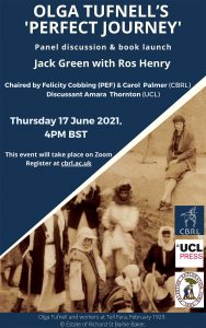
PEF/CBRL joint Webinar
Thu 17th June 2021 (4pm BST)
Olga Tufnell's 'Perfect Journey'
- Jack Green with Ros Henry
- Online Webinar (Zoom)
- Free, register at cbrl.ac.uk
Chaired by Felicity Cobbing (PEF) & Carol Palmer (CBRL)
Discussant Amara Thornton (UCL)
Please book here.
PEF/EGYPT EXPLORATION SOCIETY joint STUDY DAY
Sat 10th July 2021
Between Africa and Asia: New research from the Sinai Peninsula
- Dr Hesham M. Hussein, Ministry of Tourism and Antiquities, Dr Ahmed Shams, Durham University and Sinai Peninsula Research (SPR), Dr Konstantinos D. Politis, Hellenic Society for Near Eastern Studies, Dr Jamie Fraser, British Museum
- Online Webinar
- Tickets are £15-£25, book online, limited attendance capacity
This online study day, organised in partnership by the Egypt Exploration Society and the Palestine Exploration Fund, will consider some of the latest research into the archaeology and history of this unique landscape from its position as a frontier zone, as a melting pot for early Christianity, through to its late antiquity and subsequent historical exploration and mapping. Please book here.
Banner image: Wadi el-Zuweitin and the plateau of Gebel Katharina in the horizon. © Sinai Peninsula Research (SPR)
PEF/CBRL joint Webinar
Thu 9th Sept 2020 (4pm)
Was Jordan's Black Desert Green During the Late Neolithic?
- Eastern Badia Archaeological Project team
- Online Webinar
- Free, book online
PEF/CBRL joint lecture
Wed 26th Feb 2020 (6pm) & Fri 28th Feb 2020 (5.30pm)
The Survey of Western Palestine Revisited: The Visible and the Hidden
- Salman Abu Sitta, Palestine Land Society (PLANDS)
- PEF, 5-6 Dreadnought Walk, Greenwich, London SE10 9FP
- Tickets free, but limited seats
Limited seats – please book by emailing collections@pef.org.uk
PEF Event
Thu 19th Mar 2020 (6pm) THIS EVENT IS CANCELLED DUE TO THE COVID-19 OUTBREAK. WE HOPE TO RESCHEDULE IT AS SOON AS POSSIBLE
Excavating at Tel el Hesi, Past and Present
- Jeffrey Blakely, University of Wisconsin
- Palestine Exploration Fund, 5-6 Dreadnought Walk, Greenwich, London SE10 9FP
- Tickets free, but limited seats
Meet archaeologist & Director of the current excavations at Tel el Hesi, Jeffrey Blakely, and get a behind the scenes look at the PEF’s archaeological material from its own excavations at the same site nearly 140 years ago.
Limited seats – please book by emailing collections@pef.org.uk
PEF/BRITISH MUSEUM LECTURE
Thu 26th Mar 2020 (1.30–2.30pm)THIS EVENT IS CANCELLED DUE TO THE COVID-19 OUTBREAK. WE HOPE TO RESCHEDULE IT AS SOON AS POSSIBLE
Workers, Overseers and Interpreters: finding Palestinians in the excavations of the PEF
- Sarah Irving, Edge Hill University, Lancashire
- British Museum BP Lecture Theatre
- Tickets are £5 (£4 for BM Members)
PEF/AIAS JOINT LECTURE
Wed 29th Apr 2020 (6pm)
Fishing on the Sea of Galilee in the Early Roman Period
- Richard Bauckham, St Andrews University
- Institute of Archaeology, Lecture Theatre G6, Ground Floor, University, College London, 31-34 Gordon Square, London WC1H OPY
- Admission free. No ticket required.
All welcome. Admission free. No ticket required. Enquiries 020 8349 5754.
PEF/BRITISH MUSEUM LECTURE
Thu 4th Jun (4pm)
The Lost Fortress of Umm Tawabin, Jordan
- Alexandra Arriotti, PEF Grant Scholar
- British Museum BP Lecture Theatre
- Tickets are £5 (£4 for BM Members)
Measuring in at 144 acres, the area contains hundreds of landmarks from raised prayer platforms, to water fountains, schools, shrines, tombs and gates, each a snapshot of a history that spans 14 centuries.
Measuring in at 144 acres, the area contains hundreds of landmarks from raised prayer platforms, to water fountains, schools, shrines, tombs and gates, each a snapshot of a history that spans 14 centuries.